 By admin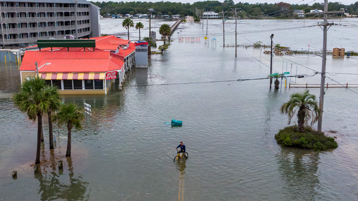
Ricky Yun, owner of Budfields on Atlantic Avenue in Garden City, opened up shop last October, days after a King Tide flooded the low-lying street.
Read more Is a new Walmart store coming near Lexington High School? What we know
But about three weeks earlier, 3 inches of water poured into the shop from another King Tide, damaging the showcases in the newly-renovated space for his hemp dispensary business. When he leased the space in July 2025, he was never told the area is prone to high tide flooding.
“The major impact, of course, the water comes into the store,” Yun said. “But more than anything else, it just traps everybody.”
July’s King Tide event saw flooding Monday night, and it’s expected to flood again Tuesday evening during high tide, reaching 6.6 feet. Other parts of the county, like Cherry Grove in North Myrtle Beach, often bear the impacts of King Tides.
Visitors during Monday’s King Tide walked through the water barefoot, pushed golf carts through the inches of saltwater and created wakes, pushing water closer to the doorstep of the many businesses that have grown used to the frequent flooding.
July’s King Tide is just one of the many predicted annually for the area, and the number of such events have increased over the years because of sea level rise.
King Tides occur during a full moon or new moon, when the gravitational pull is stronger, resulting in higher than normal tides. In Garden City, proximity to the marsh worsens recurring flooding on Atlantic Avenue, Cypress Avenue, Dogwood Drive and the streets between.
Between 2025 and 2026, the National Oceanic and Atmospheric Administration predicts eight to 13 high tide flooding days to occur based on the nearest NOAA tidal gauge, located at Springmaid Pier. Two decades ago, the average number of high tide flooding days in a year was only two.
According to long-term sea level change data, the sea level at Springmaid Pier has risen 0.75 feet between 1957 and 2025. Along the southeast coast, it has risen 0.62 feet between 1993 and 2025. Levels are predicted to rise an additional 0.87 feet by 2050.
The South Carolina Department of Environmental Services says over time, sea level rise can increase the frequency and impacts of King Tide events. Flooding worsens when a King Tide coincides with storms or high winds.
David Gee, a Garden City resident, said he hasn’t been able to tell a difference in frequency in the last 20 years, but notices the streets begin to flood when the tide reaches above 6 feet.
Read more This busy Columbia retail area is set to get a new trampoline and adventure park
“People that live here know about it,” Gee said. “The people (that) are on vacation, they don’t know what it is, and they’re driving through salt water. I have seen vehicles stalled, especially golf carts.”
Gee said the flooding starts by coming through the drains, and once the marsh overflows, the streets are fully submerged. He said the events last for a few days, but flooding only occurs for a couple of hours at a time, typically during the evening high tide.
What is Horry County planning to help with high tide flooding?
Business owners and residents speculate how the county will improve drainage systems.
Construction along Atlantic Avenue will begin this September for the Garden City Streetscape project. The multiphase project will move overhead utility lines underground, build new sidewalks and upgrade roadside landscaping, but most notably it aims to improve drainage systems and reduce the impacts of high-tide flooding.
The storm drainage system will be improved with catch basins (drains designed to trap sediment) along Atlantic Avenue and Waccamaw Drive, as well as adding double 36-inch outlet pipes equipped with one-way valves to prevent inland backflow from the marsh at Holly and Atlantic avenues.
Road elevation will be raised with curb and gutters added to direct stormwater into drains along Waccamaw Drive and Atlantic Avenue. Pervious material will be used for the sidewalks to allow water to soak through and reduce runoff, and landscaping will be added to reduce erosion and sand washouts.
The existing road elevations are lower than the ocean and marsh sea levels when higher-than-normal tides occur, submerging the low-lying streets, and water gets trapped with nowhere to drain after high tides recede, county spokesperson Kimberly Clifford said by email.
“The conditions have always been an issue and will not be eliminated,” Clifford said by email. “The improvements will increase the drainage capacity in an attempt to drain the water faster than the incoming floodwaters enter the area.”
Once the project is completed, with an estimated completion date in 2029, the number of flooding events should decrease with quicker recovery periods, Clifford said.
Read more A Blythewood bridge will be closed for 2 weeks, 8-mile detour possible for some