 By admin
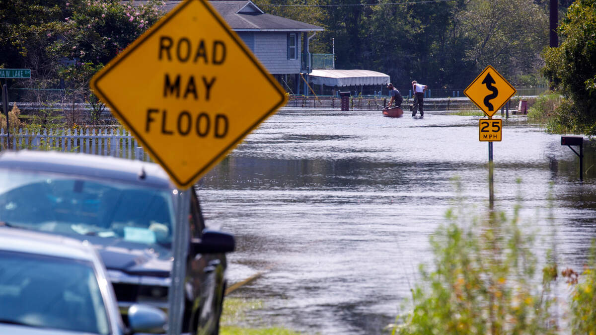
Horry County is well known for its flooding concerns around its many rivers and low-lying areas along the coast.
Read more Racist DMs to Miami football player lead Florida Bar to put employee on leave
If you are planning on buying a home or moving in Horry County, it’s good to know what areas are prone to flooding.
During Hurricane Florence in 2018 and Hurricane Matthew in 2016, historical flooding damaged homes along the Waccamaw River and the Intracoastal Waterway.
Horry County Government developed a mapping tool for new or residing residents to determine which properties fall into Federal Emergency Management Agency flood zones, where historical flooding has occurred and closed roads, nearby emergency services and evacuation zones.
The tool is called Map Your Move, and it can be used by anyone with a Horry County Government account, which is free to register.
What to know about flood zones and flood insurance
Any address that falls within county boundaries will produce information identifying flood zones, ranging from VE, AE, A and 0.2% chance of annual flooding which equates to a 500-year flood zone.
Homes in A and V flood zones, or Special Flood Hazard Areas, are required to carry flood insurance with a mortgage. Flooding is not covered with traditional home insurance.
FEMA operates the National Flood Insurance Program, which provides government subsidized insurance that protects up to $100,000 in home contents and $250,000 of building coverage. Private insurance often offers more coverage, but there are no yearly capped rate increases like the NFIP.
FEMA introduced a new tool that allows residents to purchase an NFIP policy only through Floodsmart.gov. Horry County participates in the Community Rating System, which is a program that incentivizes community flood mitigation projects and public information in exchange for discounts on NFIP flood insurance. Horry County has a score of 5, which gives participating residents a 25% annual discount.
Read more Three inmates charged after alleged shank attack at Alvin S. Glenn
However, flooding is not bound to flood zones, and many homes that flooded during Hurricane Florence were not in FEMA designated zones.
According to climate risk analysis data from First Street, nearly 40,000 homes in Horry County have a major risk or higher for flooding, but only half are mapped in areas that are required to have flood insurance.
First Street also analyzes individual properties nationwide for flood and other disaster risks.
Evacuation zones for Horry County
If a hurricane triggers evacuation orders from the governor, zones are evacuated in order from A to C and are considered mandatory. Evacuation zones are determined by potential storm surge and not by category of storm. Residents outside an evacuation zone can still evacuate, and those leaving do not have to wait until the designated time begins.
Horry County’s lists important information to know during an emergency, including essential items, evacuation zones and traffic routes.
Before a storm hits, emergency managers urge residents to create an emergency kit, including items such as water, non-perishable food, batteries, electronic chargers, a radio, a first aid kit, flashlights, identification, important documents, cash, medications, pet items, toiletries, blankets and extra clothes.
Public shelters are available, and Coast RTA provides free transportation to shelters when evacuations are ordered. Residents should look for temporary blue and white hurricane evacuation bus stop signs to find pickup locations. All rides end at officially designated emergency shelters, and return trips only stop at the designated pickup points.
Officials say residents should be self-sufficient for the first 72 hours after a storm as it can be difficult for emergency assistance to reach certain areas of the county depending on flooding or other hazards blocking a route.
Read more SC’s Jermaine Johnson’s had no federal income tax liability in last four years